Revit and Landscape Architecture: The Issues

After a bit of a hiatus, my second article about BIM and Revit in landscape architecture is now up on World Landscape Architecture:

Anyone who is familiar with BIM and BIM software has almost undoubtedly heard of Revit. Revit is a fairly popular BIM platform, particularly among architects and building engineers. It is less commonly used by landscape architects, and is frequently declared as “unsuitable” for landscape modeling. Yet the reasons behind this verdict are often left unexplained, which is not helpful for those who would like to understand more about Revit and the BIM process.

So in an effort to share more specific and useful information pertaining to BIM and landscape architecture, here are some of the biggest issues and challenges that I have discovered while using Revit, both generally and as a landscape architect.

Continue reading (on WLA)  →

Revit and Strange Civil 3D Behavior

In general, Revit interacts pretty well with AutoCAD .dwg files. Things can start to get a little strange when dealing with large survey and site files, but there are workflows that will keep your Revit file and CAD links manageable (be sure to establish coordinates).

AutoCAD Civil 3D files, however, are an entirely different matter. In the past, I have noticed that sometimes certain survey dwg files would seem to split into two pieces when brought into Revit. Here is an example, where the regular AutoCAD contours and the C3D TINN have split into opposite corners of the current cad link. Even though they are both at the correct z elevation, they are in entirely different x, y locations.

import_split

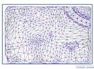
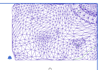
It can be difficult to notice at first, because they will be miles apart, but when you hover over the link, the blue bounding box will extend much larger than it should. The left image is an unsplit link, while the middle and right are two halves of the same link (in plan).

plan01 plan02 plan03

Continue reading